Poreño
Poreño is a hamlet in Villaviciosa, Asturias and has about 78 residents. Poreño is situated nearby to the hamlet La Garita and the locality Monte Pando.Notable Places in the Area
Iglesia de San Andrés
Church

Photo: Ramón, CC BY-SA 2.0.
Iglesia de San Andrés is a 12th-century, Romanesque-style, Roman Catholic church, located in Valdebárzana in the autonomous community of Asturias, Spain.

Museo de la Escuela Rural de Asturias
Building
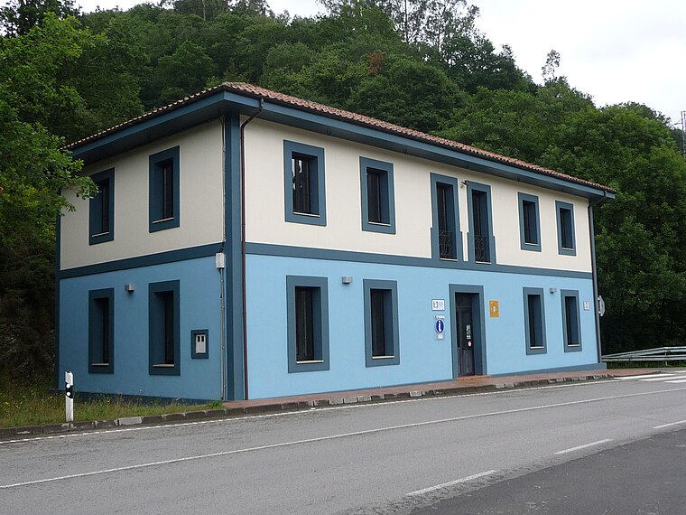
Photo: Zato-ino, CC BY-SA 4.0.
Museo de la Escuela Rural de Asturias is a building.
Localities in the Area
Viñón
Hamlet
Photo: Zato-ino, CC BY-SA 4.0.
Viñón is one of six parishes in Cabranes, a municipality within the province and autonomous community of Asturias, in northern Spain.
Pandenes
Hamlet
Pandenes is one of six parishes in Cabranes, a municipality within the province and autonomous community of Asturias, in northern Spain. Pandenes is situated 2½ km southwest of Poreño.
Santolaya
Village
Santolaya is one of six parishes in Cabranes, a municipality within the province and autonomous community of Asturias, in northern Spain. Santolaya is situated 3 km east of Poreño.
Poreño
- Type: Hamlet with 78 residents
- Postal code: 33316
- Category: locality
- Location: Villaviciosa, Asturias, Green Spain, Spain, Iberia, Europe
- View on OpenStreetMap
Latitude
43.42574° or 43° 25' 33" northLongitude
-5.44844° or 5° 26' 54" westPopulation
78Elevation
390 metres (1,280 feet)Open Location Code
8CMPCHG2+7JOpenStreetMap ID
node 5995183283OpenStreetMap Feature
place=hamletGeoNames ID
3113177Poreño Satellite Map
© OpenStreetMap, Mapbox and Maxar
Also Known As
- Poreno
In the Area
Poreño is situated close to the locality Llano Ferrero and the hamlet Celada.
Localities
- Monte VenerosLocality
- MiyeresHamlet
- El CarbónHamlet
- VegapalliaHamlet
- La PuertaHamlet
- La FayonaLocality
Landmarks
- Castillete Vieja mina antracida de Viñon
- Pico de la CorollaPeak
- Parque de NavedaPark, 2½ km southeast
- PiedrafitaPeak, 2½ km southwest
- Lavaderu LlastresSpring, 3 km southwest
- AyuntamientuTown hall, 3 km east
Escape to a Random Place
Discover the localities Navesi Settlement in Fiji and Kelurahan Jatimulyo in East Java, Indonesia.
About Mapcarta. Thanks to Mapbox for providing amazing maps. Data © OpenStreetMap contributors and available under the Open Database License. Text is available under the CC BY-SA 4.0 license, excluding photos, directions and the map. Photo: MickStephenson, CC BY-SA 3.0.