A Refresh For Yahoo Maps in Canada
Every day, many of us need to get from one place to another and often use maps for help. In fact, over a quarter of search queries on Yahoo are related to local content. Today, we’re excited to launch a refreshed Yahoo Maps desktop experience in Canada. The new Yahoo Maps makes it easier to explore and experience where you are, see where you’re headed and figure out the best route to get there.
Key new features and content options include:
Pedestrian and public transit routing: Now when you enter an origin and destination point, you can opt to see the route as a pedestrian, a driver or using public transit. The public transportation view lets you see different options so that you can pick which one looks best to you. All connections and transfers are clearly presented in a thoughtful manner
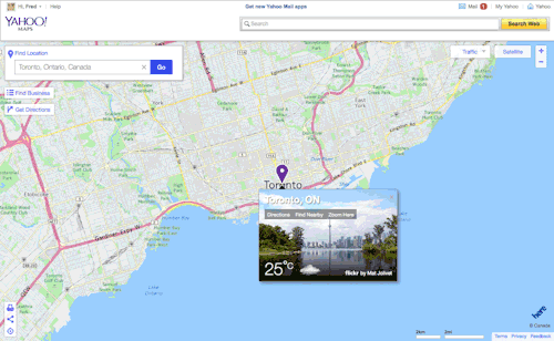
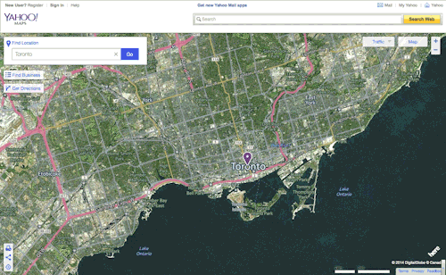
Global map controls and views: On the map view, we’ve recently refreshed satellite imagery for over 14 million square kilometers of land - significantly reducing cloud cover, improving image sampling and creating coast to coast views. For individuals as well as companies, these aerial images are key to a great maps experience - from showing someone the home you grew up in to logistics companies planning their routes. Further, new overlay options include a left rail layout for the business search experience, real-time traffic, more visible markets, a carousel of stunning Flickr photos related to that location, and local weather.
Design refresh: We’ve also refreshed Yahoo Maps so it has a more consistent look and feel with our other properties, combining the utility of maps with beautiful content and a distinctive design.
Go ahead and check out the new Yahoo Maps, available in English and French! - Fred Benz, Product Lead, Local Listings and Maps