Landsat Next Defined

Landsat Next Defined

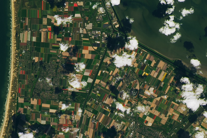
Landsat Next is on the horizon—the new mission will not only ensure continuity of the longest space-based record of Earth’s land surface, it will fundamentally transform the breadth and depth of actionable information freely available to end users. Take a look at the new capabilities that will define the next Landsat mission.

Read More »

Expanding OpenET Across Amazon Basin

The research teams who help sustain the largest freshwater reserve in the world are developing a new tool to promote more resilient farming systems in Brazil. The goal is to help farmers better handle changes in the water cycle, deal with droughts, and adapt to a changing climate.

Read More »
Landsat Next Defined

Landsat Next Defined

Landsat Next is on the horizon—the new mission will not only ensure continuity of the longest space-based record of Earth’s land surface, it will fundamentally transform the breadth and depth of actionable information freely available to end users. Take a look at the new capabilities that will define the next Landsat mission.

Read More »

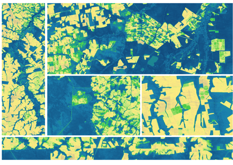
Expanding OpenET Across Amazon Basin

The research teams who help sustain the largest freshwater reserve in the world are developing a new tool to promote more resilient farming systems in Brazil. The goal is to help farmers better handle changes in the water cycle, deal with droughts, and adapt to a changing climate.

Read More »

“Landsat, a joint program of the U.S. Geological Survey (USGS) and NASA, offers an unparalleled record of our changing planet, with satellites that have been observing the Earth since 1972 to the present day.”


“Having all of this [30 m] Landsat data available more or less globally since 1984 will keep glaciologists busy for some more years, if not decades.”


“Now that the entire Landsat archive is freely available it has become economically feasible to monitor disturbance over large areas using satellite time series.”


“Without Landsat it would be essentially impossible to get good Ground Control Point locations from other sources.”


“Our Landsat-based insect atlas facilitates comparisons across space, time, and insect agents that have not been possible to date.”


“Because Landsat’s been operating for so long—thermal imaging has been enabled since the 1980s—we can study how patterns in water use have changed over the landscape over long periods of time as the climate has changed and as land use patterns have changed. So Landsat has been really a critical sensor for our work.”


“Remote sensing with satellites such as Landsat and sensors such as MODIS allows scientists to conduct a range of studies they wouldn’t otherwise be able to.”


“Over the past 50 years, eight Landsat satellites have circled the planet, which have helped to save and improve lives and support our economy. NASA will continue to work with USGS to improve access to Landsat’s unprecedented 50-year record and build on the program’s legacy.”


“Landsat 5 is kind of like the (Energizer) bunny — it just keeps running and running.”


“Landsat optically observes Earth’s surface through measurement of reflectivity and temperature in polar ice and oceans, as well as across the Earth, and these are two key geophysical parameters for measuring and modeling surface energy balance.”


“In order to produce a rock outcrop map for the entire Antarctic continent, we required a freely available georeferenced multispectral dataset. The dataset needed to cover the high latitudes; be recently acquired; be of a high enough resolution to identify individual outcrops and geomorphological features; and have suitable coverage of the continent. On this basis, the Landsat 8 multispectral satellite data was chosen for analysis as no other platform met these requirements. It would not ha…


“We have recognized for the first time that we’re not just going to do one more, then stop, but that Landsat is actually a long-term monitoring activity, like the weather satellites, that should go on in perpetuity.”


“Landsat has given us a critical perspective on our planet over the long term and will continue to help us understand the big picture of Earth and its changes from space. With this view we are better prepared to take action on the ground and be better stewards of our home.”


“The Landsat thermal sensor can provide critical information on Nevada’s water resources because it provides the only efficient and accurate way to map how much and where water is being consumed.”


“Timelapse in Google Earth simply wouldn’t have been possible without NASA and the United States Geological Survey’s Landsat program, the world’s first (and longest-running) civilian Earth observation program, and the European Union’s Copernicus program with its Sentinel satellites.”


“Whether it’s since 1985 or 2000, we see this greening of the Arctic evident in the Landsat record.”


“As one of the longest data archives suitable for this purpose, Landsat data allows us to analyze coastal wetland change over time-periods that enable us to monitor long-term directional change in the extent of the world’s coastal ecosystems and distinguish them from natural fluctuations. Our work on tidal flats and global coastal wetland change would not be possible without free access to a long-term, spatially comprehensive dataset such as Landsat.”


“Landsat has allowed managers to observe regional trends in kelp canopy area and biomass across more than 30 years. This is very valuable.”


“Landsat provides wide coverage of the Himalayas for years with spatial and spectral quality, especially now, with Landsat 8 that has enhanced spectral resolution, which enables the monitoring of glacier state.”


“When we showed historical Landsat and more recent high resolution images to communities and shared our analysis, people realized what they’d lost over time and wanted to engage in conversations about how to bring the forests back.”


“The power of Landsat is that you can travel through time and you can travel through space and tell these really rich stories to help the greater good.”


“This is really an exciting time for Landsat polar science, a new era so to speak. With Landsat Next on the horizon, the LEAP special request program and its observations of Earth’s polar regions—and the global cryospheric state more broadly—can only be expected to grow in impact and relevance.”


“We’ve got this data of every field, of every country…. the archive is just going to continue to yield good information, good science, better management, reduce costs. It’s incredible.”


“Nothing is harder to image than the past. It is imperative that all Landsat observations are archived and made available to users.”


Landsat 9 bw
Landsat 9 bw
Landsat 9 bw

The NASA/USGS Landsat Program provides the longest continuous space-based record of Earth’s land in existence. Landsat data give us information essential for making informed decisions about Earth’s resources and environment.